Eureka county Nevada
Land * Real Estate
40 Acres
Near Lander County line
    Borders BLM lands
sold
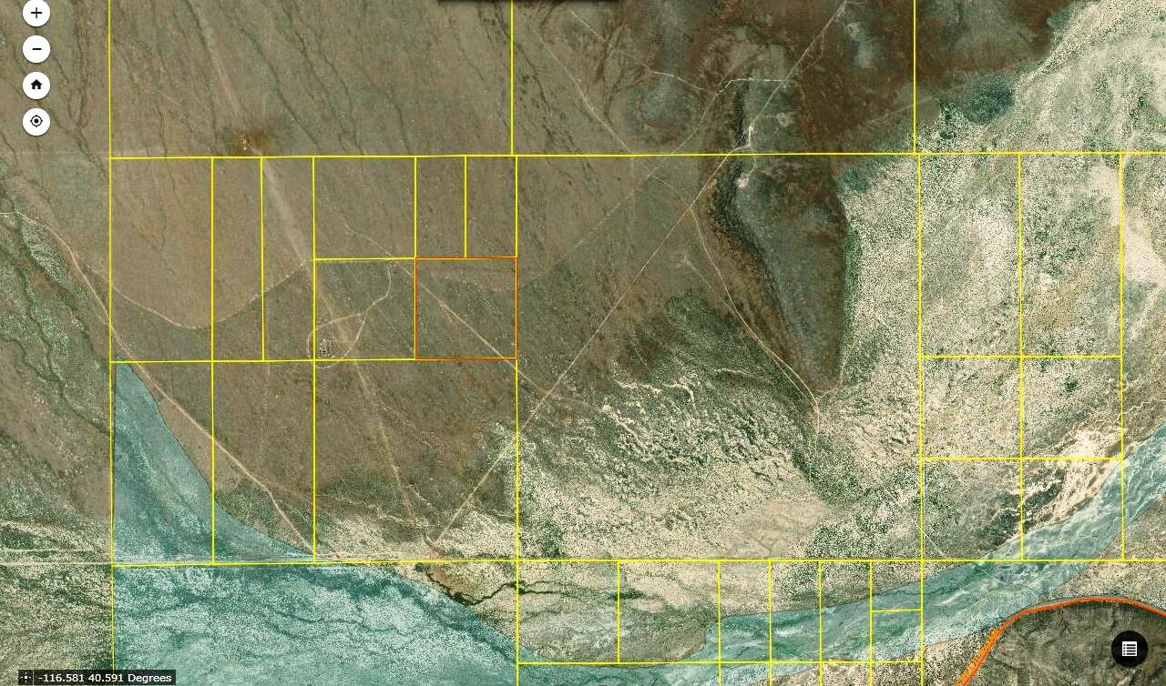
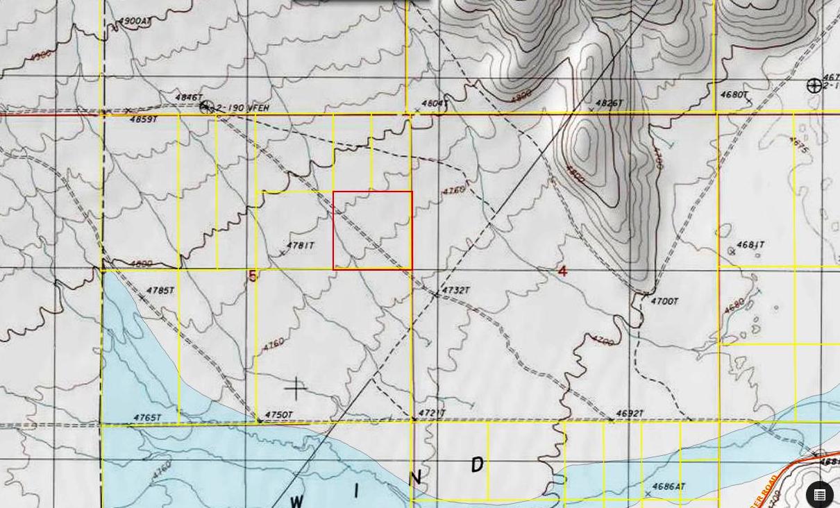
- SIZE: 40 +/- acres
- APN#: 005-010-10
- LEGAL DESCRIPTION: T32 \N, R48E, Section 5, SE4NE4
- STATE: Nevada
- COUNTY: Eureka
- GENERAL LOCATION: 13 milesdue East of Town of Beowawe. 3/4 mile east
of lander county line
- GPS (approx. ): center: 40.590622 , -116.579699 ; NW: 40.59245 , -116.58201 ; SW: 40.58880 , -116.58204 ; SE: 40.58883 , -116.57723 ; NE: 40.59264 , -116.57725
- GENERAL ELEVATION: 4770 ft.
- GENERAL INFORMATION: Dirt road thru center of parcel. Borders BLM
lands to the East. Remote.
- TYPE OF TERRAIN: level-rolling
- ZONING: check with the county for your intended usafe
- POWER: No
- PHONE: No
- WATER: no. must install well or holding tank.
- SEWER: No. Only needed when/if you build.
- ROADS: dirt
- PROPERTY TAX: $40 a year
- CLOSING/DOC. FEES: $90.
- TIME LIMIT TO BUILD: none
- ASSOCIATION DUES: none
- PLAT MAP: Request plat map
. copy and paste this webpage link (URL) into
the email
- TITLE INFORMATION: Free and clear
- Outside Info Links:
- AREA INFO: Eureka County
- Owner financing available.
No Qualifying. No Credit Checks.Gps/lats/longs coordinates are provided as a tool to assist the Buyer.
Use the maps to confirm.
BUYER TO VERIFY listings' GPS coordinates
- FINANCING
INFO and PURCHASE
INFO
price: $14,900
conversion chart land area. sq. ft. acres, hectacres, miles, etc
c: 1881.com
questions??? please email
or call us
512-478-9999
rapp
Link to Weather Underground . Historical Data &
Forecasts