Real Estate *Land
Pershing County Nevada
Remote * 11 miles west of Lovelock
Borders BLM lands to North and West
SOLD
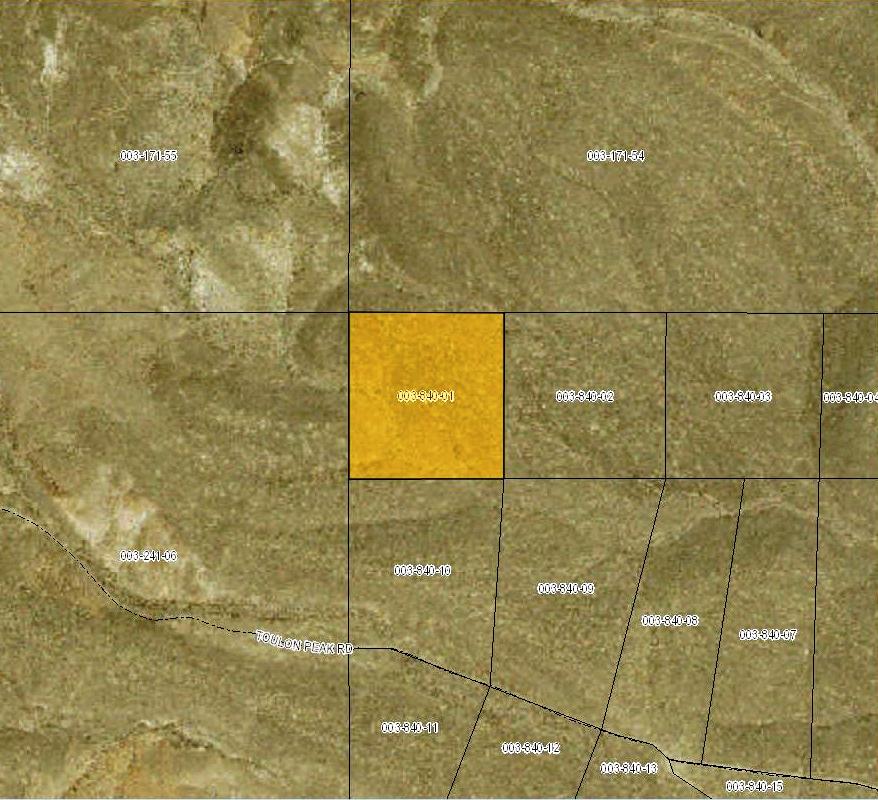
- SIZE: 41.60 +/- acres
- APN#: 003-840-01
- LEGAL DESCRIPTION: Lot 1 out of Section1, T26N, R29E out of Document #355779
- STATE: Nevada
- COUNTY: Pershing
- GENERAL LOCATION: 11.25 miles west of Lovelock. just north of Toulan Peak Road
- GPS (approx. ): SW: 40.1553 , -118.6842 ; SE: 40.1553 , -118.6797 ; NE: 40.1591 , -118-6796 ; NW: 40.1591 , -118.6843
- GENERAL ELEVATION: 4770'-4850'
- GENERAL INFORMATION: Property Borders BLM on 2 sides. No restrictions. Site-builds, mobiles, modulars allowed. Animals ok.. Camp, RV
- TYPE OF TERRAIN: Rolling to slightly sloping
ZONING: check with county for your intended usage - POWER: NO
- PHONE: No
- WATER: no. must install well or holding tank.
- SEWER: No. Only needed when/if you build.
- ROADS: dirt
- PROPERTY TAX: $77 a year
- CLOSING/DOC. FEES: $90.
- TIME LIMIT TO BUILD: none
- ASSOCIATION DUES: none
- PLAT MAP: Request plat map be sure to state the address or description of the map you want.
- TITLE INFORMATION: Free and clear
- Owner financing available.
No Qualifying. No Credit Checks.
Gps/lats/longs coordinates are provided as a tool to assist the Buyer.
Use the maps to confirm.
BUYER TO VERIFY listings' GPS coordinates
FINANCING INFO and PURCHASE INFO
NO PICTURES AT THIS TIME
conversion chart land area. sq. ft. acres, hectacres, miles, etc
questions???
please email
or call us
512-478-9999