Chaffee County
Chaffee County is on the eastern slope of the Rocky Mountains in central Colorado. Bordered on the west by the Sawatch Range, including the 14,000 foot Continental Divide, the eastern boundary of the county follows the Mosquito Range, descending toward the south. Located high in the Upper Arkansas Valley, the Arkansas River flows toward the southeast, between the two mountain ranges.
The area is the crossroads for the three interstate highways: U.S. 24, 50 and 285. Driving distance from Denver is approximately 144 miles, 102 miles from Colorado Springs and Pueblo, and 65 miles from Gunnison.
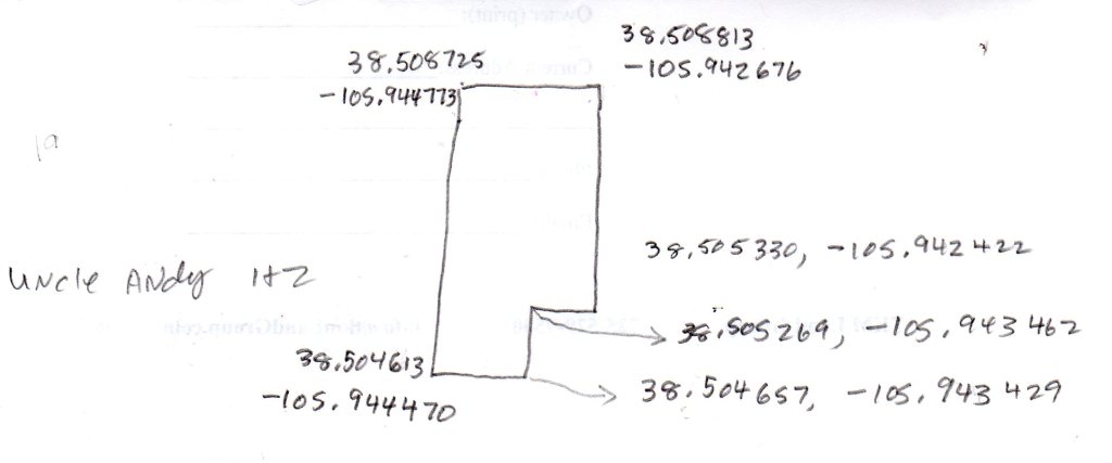
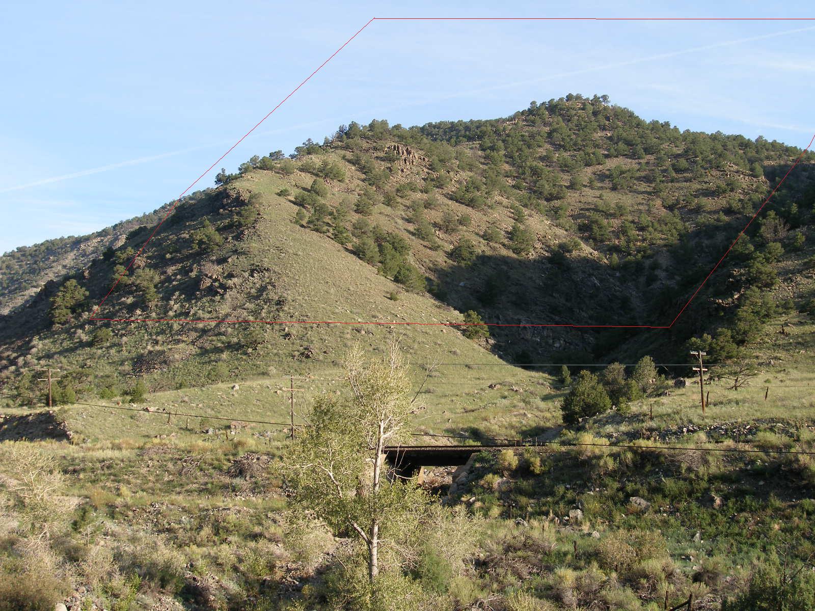
Uncle Andy 1 & 2 - 2 adjoining Patented Mining claims
surrounded by BLM/NFS lands
near Arkansas River in Big Horn Sheep Canyon
GPS (approx) points bottom of this page
| Parcel ID | Acres +/- | Description | power | Notes | $$$$ |
| 18410 | 10.3 | Uncle Andy Lode #1 | about 300' | Above the Arkansas River near Hiway 50 | $60000 for both. |
| 18410 | 10.3 | Uncle Andy Lode #2 | no phone | Above the Arkansas River near Hiway 50 | $60000 for both. |
Pics Page 1 * Pics Page 2 * Pics page 3 *