Washoe County Nevada patented mining claim
El Dorado #1 & #2
- SIZE: 120.7 +/- acres
- APN#: 071-130-04; MS#4665
- LEGAL DESCRIPTION: that portion of Section 36, Township 32 North,
Range 19 east
- STATE: Nevada
- COUNTY: Washoe
- GENERAL LOCATION: about 18 miles West-SW of Gerlach. near Powell Resevior
- DRIVING DIRECTIONS: From Gerlach take State Road 447 NW for about 7.5 miles to the Smoke Creek Road. Turn Left. Proceed approx. 20.5 miles, you will pass Powell Resevior on the right (you can't see the water just a dam of dirt) several hundred yards past the resevior there is a dirt road going to the right. follow that road for about 1-1.5 miles, head towards the canyon off to the left. Property is the Canyon.
- GENERAL ELEVATION: 4800 ft.
- GENERAL INFORMATION: 2 Historic patented Mining claims. Own your own mini-canyon. Property encompasses the canyon and both sides. Rockhounds paradise. Once in a lifetime opportunity. Scenic. Remote. No restrictions. Solitude - Remote. Mobiles, Modulars, houses, barns, RVs, animals allowed. You can do almost anything as you have no neighbors.
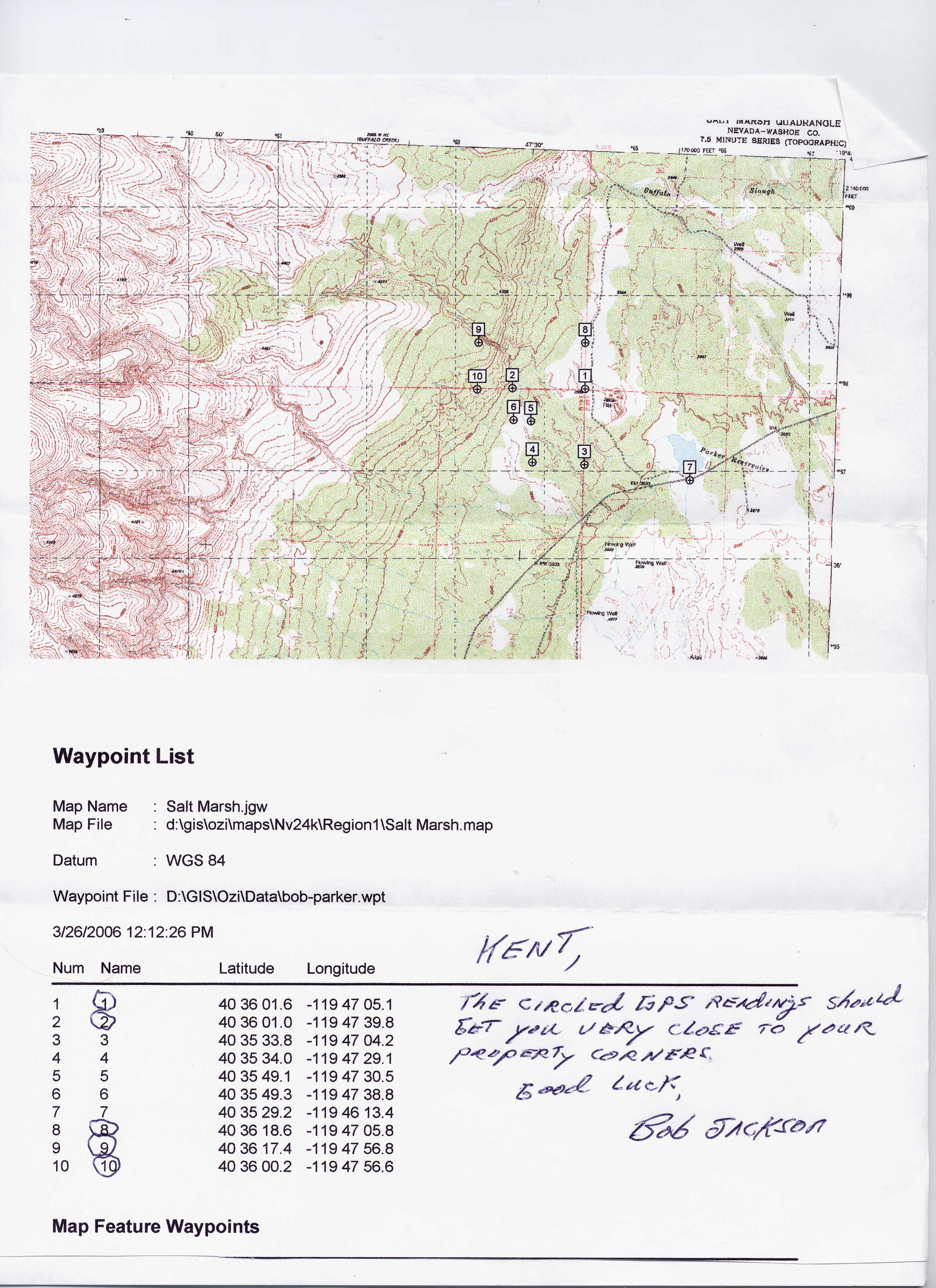
- GPS (approx): NW: 40.60386 , -119.79924 ; NE: 40.60410 , -119.78487
; SE: 40.60045 , -119.78487 ; SW: 40.60016 , -119.79927
- TYPE OF TERRAIN: level-rolling-steep-canyon
- ZONING: open
- POWER: no
- PHONE: no
- WATER: no. must install well or holding tank.
- SEWER: No. Only needed when/if you build.
- ROADS: dirt
- PROPERTY TAX: $94 a year
- CLOSING/DOC. FEES: $90.
- TIME LIMIT TO BUILD: none
- ASSOCIATION DUES: none
- Pictures: More PICS
; More PICS
- PLAT MAP: Map 1 : Map 2
- parcel
4 (circled) bottom right on plat map
- TITLE INFORMATION: Free and clear


conversion chart land area. sq. ft. acres, hectacres, miles, etc

questions???
please email
or call us
512-478-9999
