ALASKA
Land * Real Estate
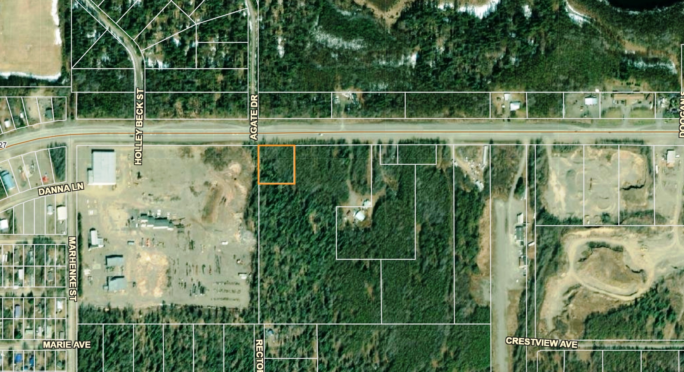
East side of Nikiski1 acre with Trees

- SIZE: 1.0+/- acres
- APN#: 01320005
- LEGAL DESCRIPTION: Portion of Gov Lot 3, section 6, Township 7, Range
11 West, Seward Meridian PTN GL 3 Beginning @ NWcorner of Lot 3 Th S
308 FT to POB; TH S 218 FT; The 200 FT; TH N 218 FT ; TH W 200 FT 200
FT to POB; Kenai Recording District, Third Judicial Distric, state of
Alaska
- STATE: Alaska
- COUNTY: Kenai Peninsula District
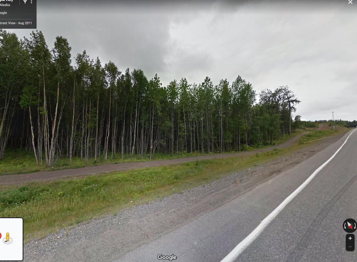
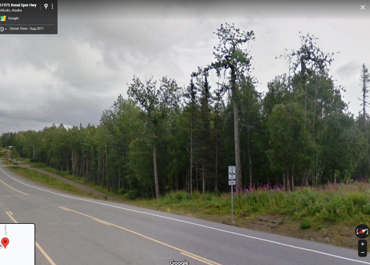
- GENERAL LOCATION: East side of Nikiski. South side of Kenai Spur hwy. east of Marhenke st., SE of Agate Dr, Intersection.
- GPS (approx. ): NW: 60.732513 , -151.285799 ; NE: 60.732518 , -151.284673 ; SE: 60.73192 , -151.284662 , SW: 60.731925 , -151.285789
- GENERAL ELEVATION: 120'
- GENERAL INFORMATION: Highway Frontage. Trees.
- TYPE OF TERRAIN: Mostly level
- ZONING: Residential. Building parcel on Kenai spur hwy
- POWER: at Hiway
- PHONE:
- WATER: no. would need to install well or holding tank.
- SEWER: No. Only needed when/if you build.
- ROADS: Paved
- PROPERTY TAX: $???? a year
- CLOSING/DOC. FEES: $90.
- TIME LIMIT TO BUILD: none
- ASSOCIATION DUES: none
- TITLE INFORMATION: Free and clear
- Outside Info Links: Kenai Borough
- AREA INFO: Kenai Peninsula
- Owner financing available.
No Qualifying. No Credit Checks.Gps/lats/longs coordinates are provided as a tool to assist the Buyer.
Use the maps to confirm.
BUYER TO VERIFY listings' GPS coordinates
- FINANCING
INFO and PURCHASE
INFO
conversion chart land area. sq. ft. acres, hectacres, miles, etc